
Drone Services
Precision Aerial Data
Professional Drone Solutions for Industrial, Solar, and Civil Applications.
Request a Quote View ServicesOur Capabilities
Deploying enterprise-grade aircraft for critical data acquisition.

Solar Inspection
Thermal and RGB mapping to detect hotspots, cell defects, and string outages. Maximize your yield with precise radiometric data.

Asset Inspection
High-resolution zoom and thermal imaging for towers, bridges, and vertical assets. Reduce downtime and improve safety.
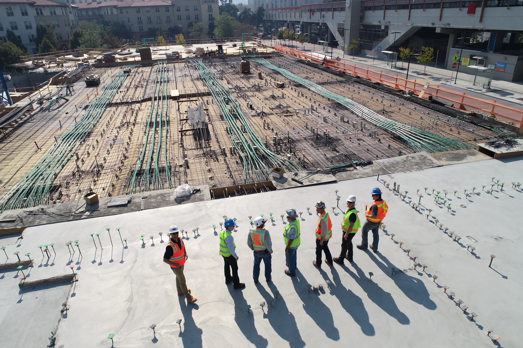
Site Progress
Regular orthomosaics and timelapse content to track construction milestones. Keep stakeholders informed with real-time visuals.

Topographic Survey
LiDAR and Photogrammetry workflows delivering survey-grade point clouds, DTMs, and contour maps for civil engineering.

Why Choose Us?
We don't just fly; we deliver actionable data. Our fleet utilizes RTK positioning and radiometric thermal sensors to ensure accuracy down to the centimeter.
- CASA Certified & Fully Insured
- Enterprise Hardware (Matrice / Mavic Enterprise)
- Fast Turnaround on Data Processing
- Raw Data & Detailed Reports Provided
Contact the Pilot
Ready to Deploy?
Contact us today to discuss your project requirements and get a custom flight plan.
Get Started